The National Emergency Co-ordination Group has been meeting in Dublin, as Storm Isha hurtles towards Ireland.
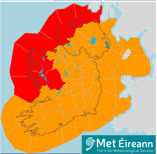
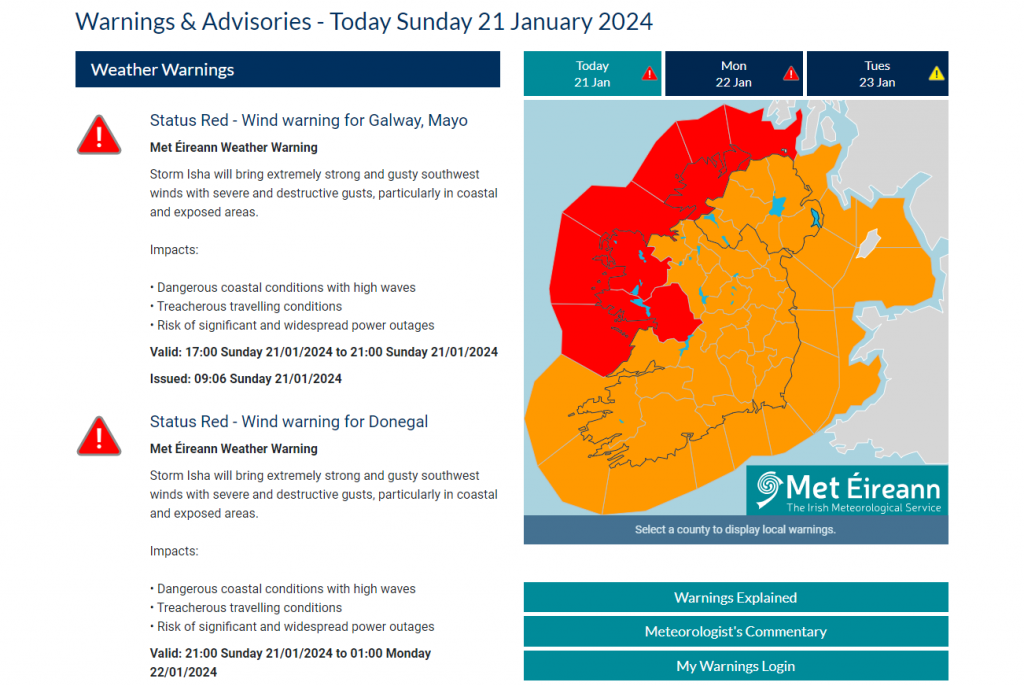
An updated status red wind warning was issued this morning for Donegal, Mayo and Galway.
An existing orange alert, which comes into force at 5 o’clock this evening will be upgraded to red for Galway and Mayo between the hours of 5pm and 9pm, with Donegal being upgraded between 9pm and 1am. A Red wind alert is also in place off the Donegal coast. Amber warnings have been issued for Derry, Tyrone and Fermanagh.
Met Éireann is warning of destructive gusts, coastal flooding, and widespread power outages.
Donegal County Council is urging people to take care this evening, saying it expects large waves along coastal paths, loose debris, difficult driving conditions, fallen trees and possible power outages.
The Road Safety Authority is urging people not to drive tonight unless it’s absolutely necessary.
Spokesperson David Martin says the situation will get progressively worse as the day goes on………….

RSA statement in full –
Met Eireann has issued a status RED warning for Donegal, Galway and Mayo for extremely strong and gusty southwest winds with severe and destructive gusts, particularly in coastal and exposed areas. There will be dangerous Coastal conditions with high waves, treacherous travelling conditions and risk of significant and widespread power outages.
The Road Safety Authority (RSA) is advising road users in areas affected by the RED warning to avoid any travel during the storm window. The RED Warning is in place from 5pm to 9pm Sunday in Mayo and Galway and 9pm Sunday to 1am Monday in Donegal.
Met Eireann have updated the timings of the Orange Wind Warnings which are for Donegal, Galway and Mayo from 4pm Sunday to 3am Monday and for Leinster, Cavan, Monaghan, Munster, Leitrim, Roscommon, Sligo from 5pm Sunday to 2am Monday. There will be very strong southwest to west winds with severe and damaging gusts and this has the potential to cause to cause very large coastal waves with wave overtopping, very difficult travelling conditions, fallen trees and damage to power lines.
The Yellow Wind Warnings are for Ireland from 11am Sunday to 4am Monday where there will be very strong and gusty southwest winds and heavy rainfall and these winds have potential to cause significant coastal waves, difficult travelling conditions, debris, and loose objects becoming displaced.
Nationally, all road users are being advised to be aware of the dangers once the storm has passed. When the extreme weather passes road users will still have to contend with potentially hazardous road conditions such as flooded roads and downed pylons, lines, trees, branches, and other debris which could block roads. Obey any road closures or diversions put in place by Local Authorities and An Garda Síochána.
Where people have to use the roads the following advice is being given on foot of the weather warnings. Motorists:
- Drivers need to slow down and allow a greater braking distance between themselves and the vehicle in front in wet weather conditions. This is especially important on high-speed roads such as dual carriageways and motorways where there is increased danger of aquaplaning.
- Take special care when driving behind goods vehicles, as they generate a considerable amount of spray, which reduces your visibility. Hold back to where you can see their mirrors.
- If the road ahead is flooded, choose another route. Do not attempt to drive through it. Flooded roads that appear shallow could be deeper than you think. The verge may have subsided and there may also be trees or branches that have fallen that may not be visible.
- Road users should always follow recommended routes and obey signs closing roads to traffic that have been put there by the local council or An Garda Síochána.
- After going through water, drive slowly with your foot on the brake pedal for a short distance – this helps to dry the brakes.
- Be Safe. Be Seen. Drive with dipped headlights at all times to ensure that you are visible and that you can see other road users.
- Beware of objects being blown out onto the road. Expect the unexpected.
- Watch out for falling / fallen debris on the road and vehicles veering across the road.
- Control of a vehicle may be affected by strong cross winds. High-sided vehicles and motorcyclists are particularly vulnerable to strong winds
- Drivers should allow extra space between themselves and vulnerable road users such as people cycling and motorcyclists as they may be blown off course by strong winds.
Advice to Pedestrians, people cycling, and motorcyclists:
- Walk on the right-hand side of the road, facing traffic if there are no footpaths.
- People cycling should ensure that they and their bike are visible to other road users by investing in a good set of front and rear lights (white at the front, red at the back) and by wearing clothes that help you be seen on your bike. Consider wearing high visibility material.
- Take extra care when crossing the road or cycling in extremely windy conditions, as a sudden gust of wind could blow you into the path of an oncoming vehicle.
- Be Safe. Be Seen. Visibility and light are reduced in poor weather conditions. Keep safe by making sure you can be seen. Wear bright clothing and consider wearing high visibility material.
For advice on severe weather driving tips, please see severe weather advice on the RSA website or check out the RSA Facebook and Twitter pages.
Please also see our severe weather warning videos created in collaboration with Teresa Mannion here.
See advice for driving on flooded roads here and some advice on driving in strong winds here.
For more weather updates, visit Met Eireann’s website: www.met.ie


