Geological Survey Ireland has released a new series of Tellus county maps showcasing Donegal from a new perspective.
The county’s granite mountains and hills with high appear with hight resistivity in the electromagnetic map.
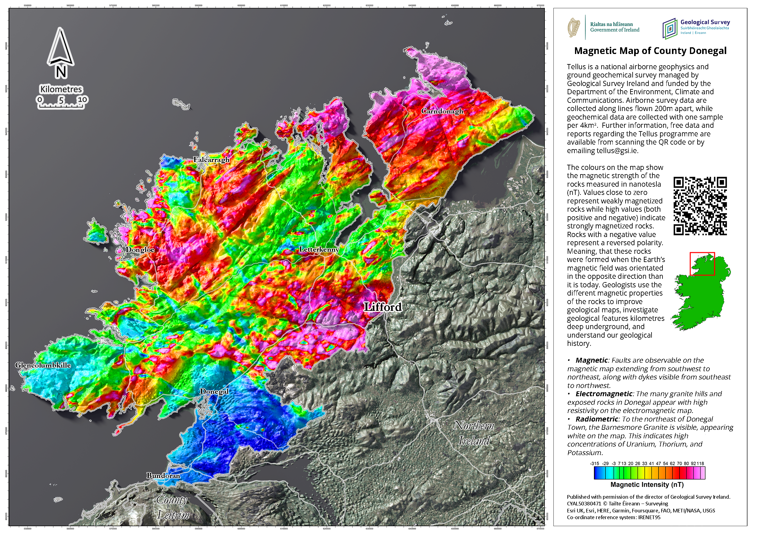
Since 2011, the Tellus programme of Geological Survey Ireland has been collecting geophysical data via onboard instruments on low-flying aircraft.
The data, showing the magnetic, electromagnetic, and radiometric properties of the land, has now been compiled into a series of county maps.
Koen Verbruggen, Director of Geological Survey Ireland, says “geologists and geophysicists have a different way of looking at things, both in terms of time and space. They use colour to represent different properties of rock or millions of years in time.”
Donegal’s granite mountains and hills appear with high resistivity in the electromagnetic map. The magnetics map reveals faults running southwest to northeast, along with dykes running southeast to northwest. Finally, the radiometrics map highlights the Barnesmore granite to the east of Letterkenny, appearing white on the map.
The data can be used for various purposes, for example, geological mapping, mineral exploration, radon risk mapping, and geothermal energy exploration.


